Tides & Tales
Tides & Tales is a community response to the loss of maritime traditions in the Waterford harbour villages, the tidal portions of the Three Sister River network, Barrow, Nore & Suir and the Waterford coastline. We focus on the maritime and fishing heritage that was once an intrinsic part of the maritime community here through research, writing and dissemination. The work is communicated via the blog, social media, books, presentations, workshops, walks and in educational settings.
Voluntary Management Committee
In December 2023 a voluntary committee was formed to seek to secure funds to offset the costs of the work which up to that point had been entirely self-financed through personal means, walks and talks. The work was and is also supported with information and images by many contributors and mentors with a deep interest in the maritime community, local history, traditions and heritage. In September 2024 we became a CLG (#772195) with a three person board. Our Chair is Breda Murphy, Secretary, Damien McLellan and Treasurer is Eoghan Hegarty.
Our Vision
Heritage Preserved, Opportunities Created
Our Mission
To foster understanding, appreciation and care for the unique culture and natural environment of the Three Sister Rivers by researching, documenting and promoting the stories, traditions, trades and river craft of the communities where the rivers meet the sea

Our Method:
- To raise awareness of the rich historic and cultural heritage of these communities that may not be forgotten or taken for granted.
- To research, record, document and publish the maritime stories and traditions that are in danger of being lost forever.
- To establish a working group that can support this work and put it on a more permanent basis.
- To finance a co-ordinator who can take a lead role in this work.
- To raise funds by sourcing grants and other income streams that are available and relevant to the project.
About The Management Committee:
The Management Committee is a not-for-profit group.
The aims of the Management Committee are as follows:
- Maintain and support the existing body of work.
- Examine the feasibility of identifying and establishing an appropriate formal framework to support the work.
- To develop a pilot project proposal.
- Explore funding options.
Our Values:
This project has been driven since inception by the principals of community development. It was born out of a desire to strengthen the social capital and community pride of the maritime communities of the estuary and rivers. Some specific values that guide us include:
- Awareness Raising. To raise the consciousness of what we have in terms of location, history, knowledge and skills.
- Empowerment. Seek to encourage an appreciation and respect for the traditions of this maritime community to get people engaged, excited and involved.
- Participation. Seek ways to include people of all ages in the process of researching, communicating and preserving the heritage of our community.
- Respect. Model respect and pride in our maritime traditions and those who practiced them and work to foster a shared appreciation of this in everything we do.
- Social Justice. Strive to put a focus on the issues impacting the maritime villages and communities and ensure that any benefits are directed towards these and not those already doing well.
Our Blog

Blockade of Waterford 1642
The following blog is an insight into an English naval blockade of Waterford and New Ross following an Irish uprising in 1641 which started the Confederate Wars 1641-1653. It is drawn from a first person account of Captain Thomas Powell of the armed merchantship...

Heritage Week 2026 preview
This year, as is our norm, the Tides & Tales project will contribute to several events both directly and indirectly, and will also promote other talks connected to our waterways or the harbour on the blog, by social media or in person where possible. Below is a...

Road to the Passage Ferry
William Whittaker Barry completed a walking tour of Ireland. His journey was later published in book form as A Walking Tour Round Ireland in 1865, by R. Bentley in 1867. I am transcribing a short excerpt here of his trip from Waterford to the Passage East Ferry, to...
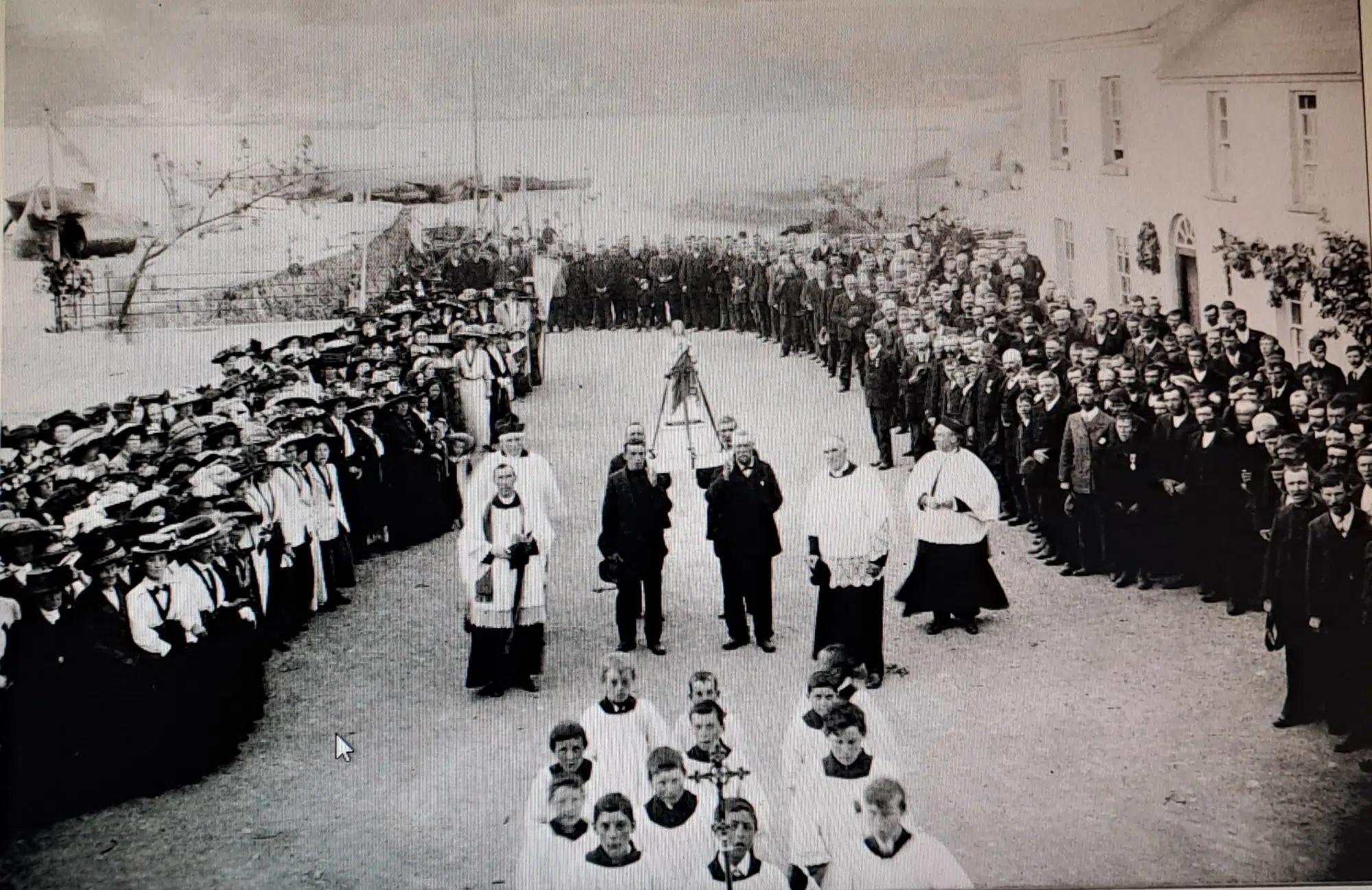
Passage East Mission 1912
This month's blog travels back to Passage East to the middle of June 1912. The origins of the story were a photo which photographer Andy Kelly shared with me some years back that he had received from Sean Furlong, who generously allowed me to use it for this story....

Viking Fishing Net Weight
On Thursday, 18th June 2026, I had the opportunity, as a member of the Waterford Archaeological and Historical Society, to join other members for a private visit to view the new excavations at the internationally important Woodstown Viking settlement. The site, which...
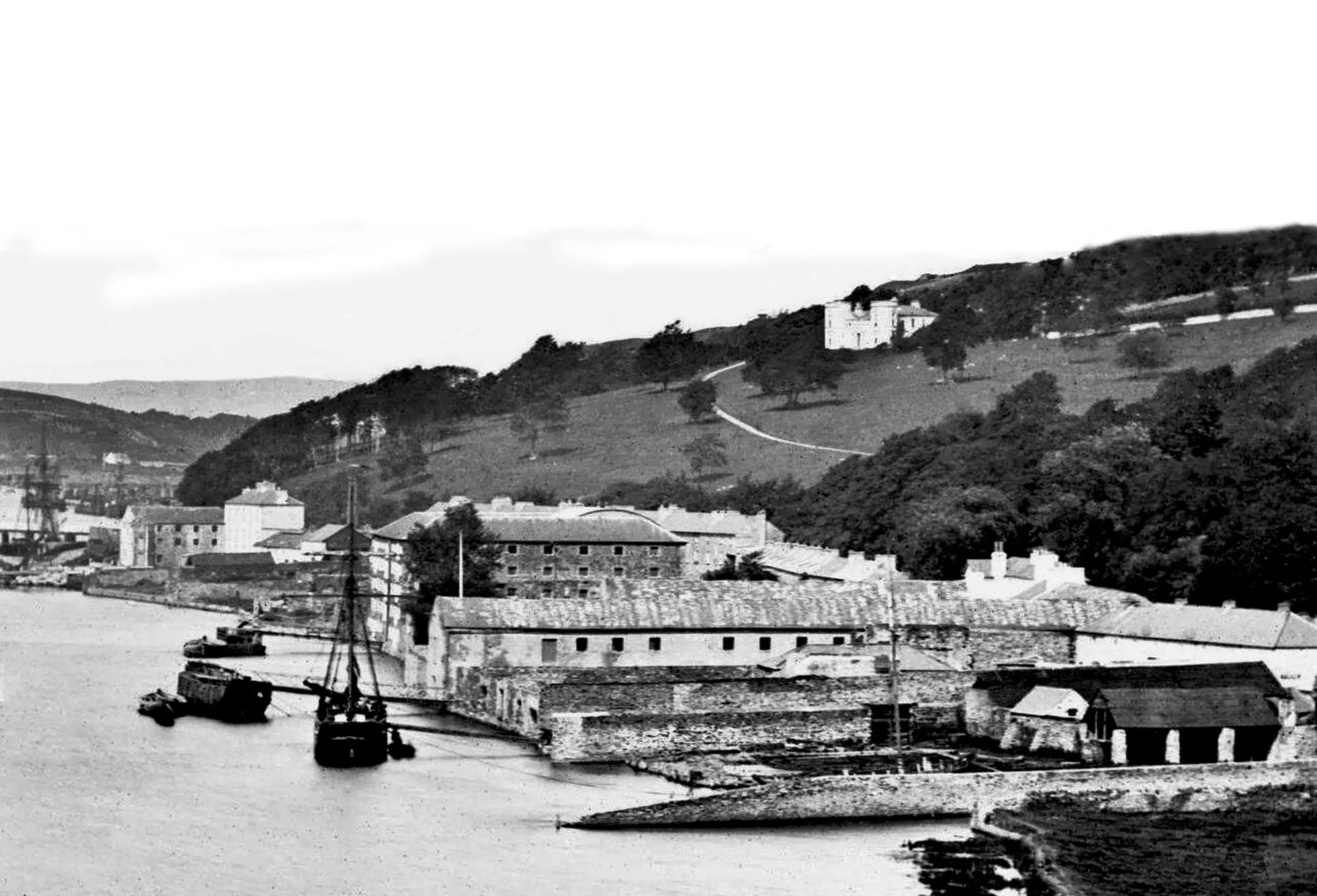
Saltees to Waterford City by steamer in 1888
A journey from the Saltees to Waterford city by steamer in 1888. Taken from the book A Trip to the South of Ireland by John Otteran Downey WATERFORD HARBOUR, RIVER AND CITY If daylight serves, our tourist friend may conclude that he sniffs as well as sights land on...