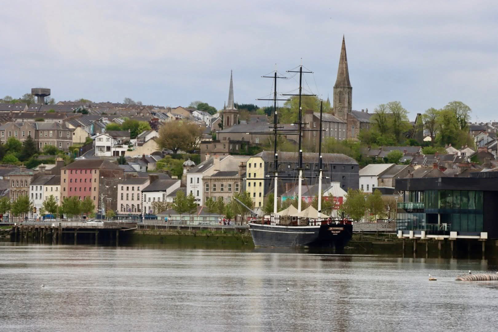
In late November 2022, disappointing news started to filter out that the Barrow Railway Bridge opening span was to be pinned open because of an operational issue. It came following an earlier threat to pin it open because of the cost of the operation- a decision that was postponed following negative community, media, and political reactions. But the rationale for the move seemed plausible to many (the timing close to Christmas was excellent I must say from the company perspective), and the opening span has been pinned open since December. But is this the end of the Barrow Bridge?
The Barrow Railway Bridge was opened as part of the works to connect the South of Ireland via Waterford to the new port of Rosslare in 1906. The last commercial train to use the line was in September 2010. The line’s viability is now being examined as part of an All Island Strategic Rail Review. The review might potentially reinstate the railway, but there were also plans to create a greenway along the route. The opening span allows ships to access and egress from the inland port of New Ross via the River Barrow.
A screengrab of the vessel (one of the Arklow Shipping craft) that collided with Pier 3 of the Barrow Bridge on February 26. Photo: Iarnród Éireann
On February 26th, 2022, a ship maneuvering inwards through the span struck the central protective dolphin. In November Iarnród Éireann (IÉ) put out a press release covered by the Waterford News & Star. The subsequent article explained that “the span will need to be held open for marine traffic as there’s an increased risk of it becoming inoperable, thus preventing vessels from traversing through it.”
Because of the collision, IÉ stated that there was a “… real risk that in the course of movements of the swing span, the span could move and strike a passing vessel” It sounds nasty, although a bit far-fetched surely! Other points were raised, although it made no more sense to me. But please read the New & Star article yourself to make your own decision.
A forelorn sight over Christmas of the bridge pinned open, the glowing lights to illuminate the channel and the red and green flashing navigation lights showing the access point. The new bridge at the Pink Rock is seen in the background.
According to IÉ the repairs could cost between €5 million and €10 million. The funds will need to be sought from the ship’s insurers…So that probably won’t be any time soon, given that almost 11 months have now passed? The South East on Track campaign group called on Iarnród Éireann to carry out the repairs in advance of monies it’s hoping to receive from insurers, but to date, this call has fallen on deaf ears.
From Cheekpoint this January 2023. A forlorn sight to see it
The opening span of the bridge was a crucial factor in alleviating the concerns of the New Ross Harbour commissioners when the bridge was originally constructed. It’s kind of ironic that the potential death knell of this magnificent piece of Edwardian industrial heritage should be sundered by IÉ on the pretext of maintaining access to the port.
To see the skill required in transiting the bridge here’s a short video I shot in 2021
Edit March 2023 – although there is still talk of the bridge reopening to cater for, initially, freight to and from Rosslare, there is no sign of work commencing on the bridge. In fact a local chap who knew the workmen who were involved in the recent pinning opening says that all papers etc have been removed and the sense given was that this was the end as far as they knew. I got excited on the 12th of March when I saw a Belgian ship called the Pompei coming in. Obviously a work boat, I hoped that it might be in relation to some repairs. Alas, it seems not, and worse, it actually struck the bridge on the way up too.
I occasionally write small pieces for my own record that I publish on the blog. These are a way of keeping a record for myself and a very different style to my monthly heritage blogs. So if you came across this and wondered what the heck…please look at my normal stuff before rushing to judgement
Although many will associate the famine as a time of mass emigration from Ireland, the fact is tens of thousands were fleeing the country for many years prior to the catastrophic events of the 1840s. Canada Street owes its name to this era, and in this blog, I want to explore how and why this came to be, and also to look at the reality of seabourn emigration from the South East of Ireland at the time.
Despite the antiquity of Waterford City, Canada St is relatively new. According to Dan Dowlings Waterford Streets, Past & Present the street dates to 1828 when the city started to expand outwards along what had been a strategically important marsh for centuries. This boggy ground, then known as Lombards Marsh, which was regularly flooded, had on many occasions helped to keep the city’s south, and southwest flank safe from invaders.
The street, as it still does today, bookended William St, beyond which was more marsh and countryside. The Richards & Scale map of 1764 shows a track leading along from William St to a Sugar House at what is probably now Newpark School. The modern Park Road passes the Peoples Park, but this was only created in 1857. The 1764 map shows a route toward Newtown, but the main road of that era was via Johns Bridge, and out Johnstown. Canada Street was constructed to connect with the Scotch Quay beside the River Suir and ran past William St to Johns Pill at the opposite end. The Pill was realigned to create the park, and so now runs several meters from its original course, but perhaps this explains the sense of a dead end at this side of Canada St for many years.
The Park end of Canada St with William St on Rt and Park Road on left. The end of the street now opens into the Peoples Park but when constructed it met St Johns Pill
As you can imagine such a location would have seen a lot of commercial trade, especially those associated with the river and waterborne trade. The bustling Scotch Quay, – the area was also known as Gorges Quay at times – ran from the mouth of the pill to the William St Bridge. I suppose we could argue that this section of St Johns River is probably best described as the Scotch Pill? Whatever about such debates, what is unquestioned is the quantity of trade associated with the area.
A screengrab from the OSI Historic Map series…note the original line of the Johns Pill is illustrated as a broken line running to the west of Canada St
At one point the most prestigious industry associated with the street was Neptune Ironworks. Neptune Cottage was located where the present Marina Hotel operates. Behind this, the Malcomsons operated the Neptune shipyard (1843 -1882)- the location for some of the finest steamships built in the world of that era. But the name of the street owes itself to another Quaker enterprise – that of the Graves family – although in this case the partnership of Watson and Graves which were operating at the time that the street was built.
The river end of Canada St, the Marina Hotel now stands where Neptune Cottage once stood.
In 1828 when the street was laid out, the quaker partnership of William Graves and a man named Watson was operating an office from the new street and also in New Ross. I can find little information about Watson, the name does not feature in any street directories that I have and it seems from a newspaper article I chanced upon from 1834 that the partnership may have dissolved in difficult circumstances. William Graves would continue to flourish, however.
An advertisement of the time
Watson and Graves was the local agent for the Canada Company then settling eastern Canada. Advertisements were posted seeking people with an agricultural background with “sober, honest and industrious habits” to settle the lands taken from native tribes ( 1 million acres alone around Lake Huron alone). Of course, much of these lands needed to be cleared for agriculture which provided another welcome cargo home on the ships. When the emigrants were carried across the Atlantic, the holds were cleared of their temporary bunks and bedding and stuffed with lucrative shipments of Canadian timber for the return trip to Waterford. The timber was landed close by, and in my own childhood Graves timber yard still operated from the area.
Advertisements were carried in local papers and the terms offered must have seemed mouthwatering to Irish families who were suffering so much neglect and abuse on their own native shore.
The CANADA COMPANY, desirous of settling their Territories with EMIGRANTS, of sober, honest, and industrious habits, offer the following inducements to such:—The Company will give the choice of the valuable Lands of the Province ; and, as the object of the Company is not to encourage or deal with Speculators, but to open access to their Settlements bv steady and Agricultural! Population, to Individuals, or Families, or Associations of Families of that description, the Company will afford every fair and liberal Encouragement regards Price and Terms of Payment. In order to place within the reach of poor Individuals of good Character, a Settlement, the Company will erect Houses, and grant Sums of Money, to enable such Settlers cultivate their Farms, and provide for their Families, until they can raise crops from their own Lands, by which means the Payments those Advances can neither inconvenience nor distress the Settler. The Company has entered into Contracts with the Proprietors of Steam Boats and other public Conveyances along the Lakes and River St. Lawrence, to convey their Settlers at about one-third of the Price less than others are charged, which arrangement only Twenty-two Shillings and Six Pence is charged for grown People, and Half that Sum for Children, for the passage from Montreal to York, the capital. And Settlers going to the new Town of Goderich , on Maitland River (Lake Huron’, from Buffalo or the Welland Canal, are, during the present season, conveyed free of charge.
The Company are allowed by Government to expend £45,000 in opening Roads and other useful Public Works. The well-conducted Farmers and labourers of this Country, are now offered inducements to emigrate, which never before existed, and are within the reach of every individual who can produce satisfactory vouchers of good character from two Magistrates, and the Protestant or Roman Catholic Clergymen of their Parish, to WATSON and GRAVES, Agents to the Canada Company for Ross and Waterford.
Waterford Chronicle – Saturday 24 May 1828; page 3
This advert appeared in numerous papers around the SE during the spring and early summer of 1828. To get a sense of the numbers travelling at the time, here’s a flavour from April 1831;
On Tuesday last the City of Waterford John Morgan, master, dropped down the river, bound for Quebec. Her ample deck was crowded by passengers their number was, we are informed, 103 adults ; 17 under fourteen years; 30 under seven- total, 150. The Ocean, Joseph Hearn, master, also departed same day for Quebec. Her passengers are stated about eighty. Several other vessels, both here and at Ross, are preparing sail for different ports of America, including Newfoundland.
The invulnerable, Frances and Mary and Little Ann, are to sail in the next few days for Newfoundland with passengers; also the Don and Argyle for Halifax—the latter has about 180 passengers on board. The Bolivar, with a large number passengers is bound for Quebec.
The Town of Ross sailed on the 30th ult., from Ross for Quebec, having on board 230 emigrants; upwards of 150 of them had their passage and provisions supplied their benevolent and humane landlord, the Hon, Butler Clake Wandesford brother to the Marquis of Ormonde
Waterford Mail – Saturday 09 April 1831; page 4
The same article also gives a sense of the dangers and human cost of such journeys, in these cases, even before they have to endure the Atlantic. For example, William McGrath died at Passage East after falling into the hold of the ship Ocean. His wife and 8 children were aboard at the time. An unnamed woman from Thurles in Tipperary died in a lodging house in Waterford where she was waiting with her husband and 7 children on a ship to Halifax. Finally, a small boat overturned after leaving the quay with emigrants who were being rowed out to the ship Argyle which was at anchor in the middle of the Suir. All survived after seamen went to their rescue it was believed.
We explored the difficulties posed by cholera in this era before and the reception that awaited emigrants at Grosse Isle Quebec
Carlow Sentinel – Saturday 14th July 1832; page 1
Today Canada Street is a commercial and residential area, much like it was when it was named, but it is now firmly located within the city which has extended many miles into the countryside. As a nation working to accommodate immigration from many war-torn and economically deprived countries, and where the rise of anti-immigration sentiments are rising, it’s perhaps no harm to be reminded of our own history of having to flee.
I’d like to thank my readers for all the support in 2022 and wish you and yours a very happy, prosperous and safe 2023. If you would like to join my small but loyal mailing list, you can add your email below and get an email update on each blog published directly to your inbox.
The City of Bristol departed the quay of Waterford in November 1840 for her home port of Bristol in a gale of wind. Anxious to keep to schedule the vessel would sail into one of the worst storms that season. She would later run aground, break up and all but two of the twenty-seven souls aboard would die.
PS City of Bristol – photo accessed from http://www.brecon-scuba.org/page.php?id=283
The City of Bristol(1828) was a familiar ship in the coastal trade of Ireland. She was a paddle steamer, built of timber, 209 tons, 144ft long and 35ft wide including her paddle wheels. She was two-masted, schooner rigged, and had main, quarter, and forecastle decks. Built by the War Office Steam Packet Co, in Bristol she was owned and operated locally by a consortium of local merchants. However, at the time she was lost the ship was in the ownership of the Bristol General Steam Navigation Co and had just undergone an extensive refit. The vessel was a regular into Irish ports including Cork and Waterford but especially Dublin it seems – where she was known to carry troops to and from the island, and also convicts amongst the more usual freight.
A contemporary advert highlighting the regularity with steam brought to sailings, and also perhaps some of the pressure that Captain Stacey may have felt in meeting his schedule. Sourced from Waterford Mail – Wednesday 11 November 1840; page 3
On Tuesday 17th November the steamer departed Waterford’s quay for her home port of Bristol. The vessel had become a regular on a route that had a long history between the ports of Bristol and Waterford. At 10 am she was observed outbound at Passage East. Her Captain, John Stacey who had only taken charge of the vessel in the previous six weeks. Stacey however was described as knowing the route well, having served man and boy on it, first on sailing ships and later steam. Rounding the Hook he decided to return, following what was described as “…a frightful sea…” He anchored in Duncannon Bay, where he awaited the abatement of the storm, setting off again at 11 pm that same night.
Aboard the City of Bristol was an estimated 21 crew and possibly 6 deck passengers. Of the passengers little is known, most it seems were stockmen (John Sullivan is the only name of the stockmen recorded it seems), along to care for the livestock aboard. The ship’s manifest included; 575 barrels of Oats, 113 barrels of Barley, 2 tierces (casks) of lard, 120 flitches of bacon (a side of a pig ), 280 live pigs stored in pens on deck, and 15 head of cattle housed in the forehold.
As she crossed to the Pembroke coast later in the afternoon of the 18th of November the storm once more rose in strength from the SE and in near zero visibility due to snow Captain Stacey decided to seek shelter behind what he believed to be Worm’s Head to the east of Swansea. With only glimpses of land and features, Stacey was in a very difficult navigational position. After 6pm land was sighted, however, Stacey was mistaken in his calculations. He was actually at Burry Holmes a few miles to the north (perhaps as little as 2!), and instead of finding a safe anchorage where they could have weathered the storm, breakers were spotted. The captain reacted swiftly trying to get the ships head to the wind and this was partly successful, but she grounded by the stern and when she turned broadside to the waves, all hopes of getting off were lost.
They had grounded in Rhosilly Bay, close to the village of Llangennith and although the cries could be heard from the shoreline, the locals were powerless to help. The crew could do nothing in the savage seas to launch a boat for fear of being washed off the deck. As the tide rose and the seas with it, there was little they could do except lash themselves to the rigging and hope for rescue. Broadside to the pounding waves she was battered and beaten and finally at highwater sometime close to midnight, the ship broke in three parts and all aboard were tossed into the surf.
Location of the wreck in the Bristol Channel (Or the Severn Sea as it was also referred to at the time occasionally)Stacey had planned to make Worms Head where he was assured of a safe anchorage to weather the storm, however he was north of it, close to the village of Llangennith
Perhaps miraculously, three of the crew made it alive to shore, but only two survived. An unnamed man was dragged from the waves but never regained consciousness. Seaman William Poole was saved when a timber beam he grabbed in the water carried him in. He suffered three broken ribs and could barely walk when he floated ashore. He was clutched from the sand by locals who were standing by. The ship’s carpenter, Thomas Anstice managed to swim the distance and walked out of the surf towards a fire that was blazing as a beacon on the beach. Both men would later give evidence at a local inquest and helped to identify the bodies of those of their crewmates who were fortunate to be given back by the sea. 72 pigs and 4 cattle also made the shoreline and walked off the beach to safety. Here’s a list of the crew that died which includes a photo of Captain Staceys grave.
Meanwhile in Bristol, there was little by way of anxiety about the late arrival of the City of Bristol, where it was assumed that the vessel was sheltering from the violent storms. But by the second morning (Thursday) fears were mounting and a large crowd had gathered in the ports Cumberland Basin where the packet boats normally arrived. The first news came via County of Pembroke on her run from Tenby and further information arrived by other ships and post. The city was devastated by the loss, 13 of the crew were from the village of Pill, described by some as the nursery of Bristol seafarers.
Cumberland Basin in 1850s by ET Dolby. Sourced from https://bristolcitydocks.co.uk/cumberland-basin/
In the coming days, the full horror was realised and later a public subscription was established to try to help the widows and orphans who were left without an income. When the account was published in May of the following year £900 had been raised for the families and it allowed a payout of £15 to the widows involved and £14 to each of the 34 orphaned children.
Locally, the Waterford Mail gave widespread coverage of the loss but it did include some details pertaining to the city. For example about Captain Stacey, who in some quarters was held liable for the loss, there was the following:
“Captain Stacey, the master of the unfortunate vessel, had been known here for forty years, during which time he had been in sailing vessels and subsequently in steam packets between this port and Bristol. Intelligent, zealous, active in the onerous and responsible situations that he most creditably filled for many years, was held in high consideration by his various employers ; while in the walks of private life and social intercourse he was most highly esteemed and respected, and few could depart more deeply regretted a numerous circle of friends than Capt. John Stacey. His melancholy fate is indeed the subject of general, public, universal sympathy and regret.”
Waterford Mail – Wednesday 25 November 1840; page 2
Of the cargo:
…300 brls of oats, 2 trs of lard and 100 pigs, belonged to Mr. Finnucane, of Ballybricken, and we believe, very little has been saved of the property. Mr. Fennelly, a bacon merchant in Clonmel, lost 50 bales of bacon ; Mr. Murphy, of Clonmel. 100 sacks of oats; and Mr. Cooney, 100 sacks of oats.
Waterford Mail – Wednesday 25 November 1840; page 2
of the passengers, we learn that “among those who perished was a lad named Thomas Henderson, the son of honest parents, in the clothes trade in Patrick Street. Apparently, Thomas was travelling to London to purchase second-hand clothing for the family business.” Slaters Commercial Directory of Ireland (1846 ed) lists Thomas Henderson as running a Clothes Dealer business at 29 Patrick St. He is one of numerous such outlets on this street. The property is now Ryans’s Shoe Repairs (and collectibles!) The Mail also mentions “… a young man of the name of Walsh, who lately came here from Liverpool, and was returning by way of Bristol, also perished” No details are given about the only female passenger aboard but apparently there were two others who were aboard the City of Bristol, but who at the last minute stepped off the vessel and she sailed without them. Both ladies were unnamed and no other details emerged as far as I can tell – they would have got a book deal out of the same fortune in this day and age.
Today’s piece is taken from reportage at the time from an article in The Wexford Independent, 25th November 1840, The Waterford Mail, cited above and George Harries – Early Bristol Paddle Steamer Shipwrecks, 1993, The Longdunn Press, Bristol and Tom Bennett, Shipwrecks Around Wales Vol 1, 1987 Happy Fish Press, Newport, Wales. I’d like to thank Frank Cheevers who originally shared the story with me on Facebook
Recently my good friend David Carroll made a gift to me of Cormac Lowth’s newly published comprehensive and beautifully illustrated book – Ringsend Sailing Trawlers. With Some History of Boatbuilding in Ringsend. The book captures the maritime, fishing, and seafaring industry connected to the Ringsend area of Dublin. Spread over 32 chapters it charts the origins of the small fishing community on the bank of the Dodder backing onto Dublin Bay, the arrival of Brixham trawler families, the conflict that emerged with local fishers, and the reality of life in the area, particularly in the 19th and early 20th Century.
I think for Cormac the stars of the show are the people of the community, but they are firmly staged against the backdrop of Dublin Bay and the vessels that became synonymous with the area, not alone as fishing boats, but as sailing boats in regattas, pilot boats and workboats. There was also a thriving boatbuilding industry which Cormac charts in a very detailed manner.
What stands out for me in the book is the detailed descriptions of many daily activities now lost to the steady march of progress. For example, he gives an account of beam trawling from the setup of the system, the launching, and the fishing practices. How many in the country at present would even know what a beam trawl was, let alone know how it was fished? It evoked a wonderful memory of working the same system here in the Ross River with my father and Uncle John in my childhood. In other cases, he mentions almost as an aside, that glass balls, which were used for buoys on the nets, were made by the local glass manufacturers in the village. I remember them on the mantelpiece at my Grandfather’s and only now thought to wonder where they were made – perhaps locally in Waterford? I was also reminded of my grandmother Moran recalling her mother making nets and string for long lines at the fireside all those years ago, the toughness of the life, but the skill and resilience of the people. Although I have never met Cormac I think that this is an admiration and appreciation that we share if the book is anything to go on.
A sense of the contents
Perhaps my favourite part of the book is the introduction, where he recalls his early years with his father who had bought a boat called the Pride of Ardmore and with local help had established a safe mooring and over time converted her to a motor sailing vessel and also rigged her to trawl. These local salts were the direct descendants of the sailing men, many now fishing part-time and they shared the knowledge and love of the Bay that seems to have had a direct bearing on Cormac’s life.
There are so many other wonderful pieces to the book, the street names prior to redevelopment including Ropewalk Place, the names of the fishing families, and the ancillary trades that abounded. Although I was already aware via David Carroll, I was delighted to read about Pill Lane where the fish market once thrived before the corporation made efforts to impose order. Obviously, I updated my recent Pill placenames blog as a result of Davids’s guidance. It’s a book filled with such historical nuggets that shine through.
If I had to be picky and find fault, I guess it would be against myself and my own lack of knowledge about the area, that certainly would have added some clarity and context. All told I can only heartily recommend this book and urge you to get it before the limited production is sold out. If I had to bet, I’d say it’s one of those books that won’t be found in second-hand bookshops, the owners like me will cherish it.
The book Ringsend Sailing Trawlers By Cormac Lowth is published by Peggy Bawn Press. It retails at €27 I believe and can be ordered directly from Cormac by emailing cormacflowth69@gmail.com Or you can order via eBay
In 1906 the River Suir was vibrant if weakening commercial thoroughfare transporting goods up and down from Clonmel to the sea on a daily basis, just like our motorways today. The boats used were flat-bottomed lighters (also called yawls above Carrick and barges) and they worked with the tides using poles, oars (sweeps), rudimentary sail or in the case of one company a steam tug. All used the tow-path above Carrick. This article explores the era, teetering as it was on the edge of fundamental change.
Introduction and context
This article is drawn from a Royal Commission report on canals and waterways and it gives a very clear if a biased picture of the river of this era. The evidence presented by J Ernest Grubb and James Phelan is from a river-centric perspective and there are two points I would like to make 1.) Both men were part of the fabric of the river trade and no doubt their evidence was slanted towards making the case to preserve their business and a fast-eroding way of life. 2.) This is based on my reading of their evidence and I homed in on points that interested me. As regulars will know I am fundamentally biased when it comes to river matters.
Lighters at Carrick on Suir, Robert French photo courtesy of Maurice Power. These are located on the northern bank on the lower side of what was then the Dillon or Red Bridge, the present road bridge
Royal Commission
In 1907 a Royal Commission reported on the canals and waterways of the British Isles – which obviously included Ireland at the time. The purpose of the Commission was to travel around the country and take evidence from interested parties. However, rather than just a bitching and moaning session, the Commission also challenged evidence and put the onus on the parties to be solution focused. A number gave evidence about the River Suir, particularly above the City with a specific focus on the towns of Carrick On Suir and Clonmel. This blog will explore the evidence of just two of these; J Ernest Grubb of Carrick and James Phelan of Clonmel, both of whom operated lighters on the route.
J Ernest Grubb (1843-1927) in 1925 sourced from J Ernest Grubb of Carrick on Suir (1928) by Isabel Grubb. Image courtesy of Maurice Power
J Ernest Grubb was managing owner of the Suir Steam Navigation Co (Est 1877) and director of John Grubb & Son Corn Merchant of Carrick & Clonmel. He was also a member of the Tipperary SR Council. James Phelan was from William Phelan & Sons Clonmel (New Quay & Parnell St) and he stated that they owned 8 boats working on the river and operated to Waterford. Phelans employed about 16 horses to drag the boats up from Carrick, normally 12 sufficed for the one run but more horses were required if the river was in flood. Phelan stated that 2/3 of the transported goods were inwards to Clonmel.
The Phelans on Clonmel from Slaters Commercial Directory of 1894. I can’t say they are all the one family of course. The current view of what Phelans of 25 Parnel St, and the lane (Dowd’s Lane) leading down to the quays
River Suir Navigation Co
Grubb clarified early on that Suir Steam Navigation Co (SSNCo) was a separate entity to the River Suir Navigation Co (RSNCo) which was established as an incorporated company in 1836 by an act of parliament. This company was charged with “improving and maintaining the navigation of the River Suir…” and for the construction of a “ship canal” at Carrick On Suir. It was funded from a levy of 1d per ton on seagoing craft above Grannagh. This canal was made by cutting a channel through limestone rock on the south side of the river just below Carrick On Suir allowing “ocean-going craft drawing 10 or 11 feet of water” to reach the town (Only possible on spring high tides it seems and in another section of evidence Grubb stated that to that date the largest vessel seen in Carrick was 300 ton). The extent of influence was from Grannagh Ferry upriver to Carrick Old Bridge. The RSNCo had no influence above Carrick – this fell to the council and it seems only to Tipperary (because of the tow path) and the river was left to the rivermen and boatowners to maintain.
Carrick to Clonmel towpath
Above Carrick, a towpath was constructed many years since (1750-ish it seems with further work in 1793 including the path, walls, and quays) and repaired occasionally along which lighters were towed upriver by horses against the flowing river. Previous to the construction of the towpath men and women had physically dragged the boats against the tide by hand along the riverbank, stumbling and falling over rocks, ditches, and stumps no doubt.
The lighters (or more accurately called yawls on this stretch – but I can see no discernible difference in design and build, except the loads carried were less) could drop down with the tides, but needed to use a breaking system of chains and other means to slow the run. Clonmel to Carrick was a distance of 14 miles and could take 5 to 6 hours upwards, but much longer if the river was in flood. Here the river falls all the time, only becoming tidal at Carrick. It was a further 16 miles to Waterford. In evidence, Grubb stated that apart from the Tipperary council maintaining the towpath, no one took responsibility for the river, only the rivermen. The council also maintained the quays in Carrick, but the Clonmel Corporation took charge of the town quays or “river quay”.
Grubb was of the opinion that barges (or lighters – the phrase was interchangeable but I will use the latter from here on) could carry up to 60 tons between Carrick and Waterford or beyond. 45 was the average. The lighters transhipped at Carrick to go on to Clonmel. This involved breaking the loads down between two or three craft depending on the level of water on the route. They also navigated the smaller rivers or pills such as Pilltown, Portlaw Pill (R Clodiagh), the Pouldrew Mill Pill, Kilmacow Pill (named Black River by Grubb – but generally known on maps today as the Blackwater). Grubb considered 35 tons to be the maximum limit on these.
Freight
The main freight downriver included oats, condensed milk, wool, eggs, fruit, honey, willows, and native timber. Freight inland included coal, grain, flour, feedstuffs, foreign timber, shop goods, agricultural implements, and machinery. Grubb estimated that 19 out of every 20 tons carried to Carrick was by water at the time – however, we might say at this remove, he would! Once the goods landed along the riverside quays, they penetrated inland by up to 20 miles, and they covered an area that included the counties of Waterford, Kilkenny, Tipperary, and Limerick.
Timber export from Clonmel as photographed from off the Gashouse Bridge. (The gas works which would have depended on significant coal imports by yawl were on the right hand side of the road that led off the bridge (on the town side)How it looks today
Railway
They competed with the railway for some freight – particularly perishables like butter, poultry, and milk. Also, some English firms had contracts with the railways which included carriage in Ireland as part of the overall cost which worked against the rivermen.
Phelan was of the opinion that the river helped to keep the railway freight charges in check. He gave a specific example of corn costing 4s 10d per ton to ship by rail from Waterford to Kilkenny. Yet the same distance to Clonmel was costing 2s 6d because the railway had to compete with the river. In another saving, he explained that the rivermen allowed freight to avoid the toll on Waterford City’s only bridge at the time (Timbertoes).
Number of Boats
As regards the craft employed Mr. Grubb stated that 14 persons in Waterford were working lighters employing about 32 barges at the time. All these boats were carrying at least 40-45 tons per trip and generally work within a 10-mile radius of the city. There was also craft from all the villages and rivers on the river including as far as New Ross. The Grand Canal Co was also involved and linked the area to Dublin and Limerick via the canals and the Shannon. 6 parties owned lighters between Carrick and Waterford City, there were then 26 barges owned at Carrick by 10 individuals or firms. 14 businesses traded from Waterford to Clonmel, and 12 operate only between Waterford and Carrick. He estimated that a total of 70 craft were then employed on the river. He estimated that at the time there were 19 boats operating between Carrick and Clonmel – in contrast, he claimed that in 1835 there were 93.
An image of the Fr Matthew steam tug with two lighters in tow (and it seems a third is being poled either in or out into the tidal stream) at Carrick they are proceeding downriver from what is now the road bridge – a Sonny Cash image. Courtesy of Maurice Power
Grubb employed the steam tug Fr Matthew to tow up to four lighters on the Waterford to Carrick route, although many operators still used the tides, oars, poles, and sail. It seems Phelans preferred the traditional methods below Carrick, but as mentioned previously transhipped and broke the loads down at Carrick to be towed on by horses to Clonmel. Many issues were presented however, floods in winter, shallow in the summer during drought, and the ongoing deterioration of the towpath – which was washed away or undermined during floods. The cost of maintaining the horses was a drain on the viability of the Phelan enterprise and was the cause, he claimed, of others leaving the business.
Traffic
Grubb submitted the following example of one week’s freight in the Spring of 1903:
108 cargos of 2,695 tons
To and from places east of Carrick 33 cargos = 920 tons
To and from Carrick 25 cargos = 1,125 tons
To and from Clonmel 50 cargos = 650 tons
A faint photo of the yawls working the Clonmel run, note the horses inside on the towpath – from LM McCraiths The Suir: From its source to the sea (1912) p.60. McCraith says nothing about the photo just captions it thus: “Like a long sabre at a warriors hip” a bit too flouncy a description for my liking Although now part of the blueway, the towpath (seen here at Kilsheelan) is still there for all to see
Solutions to the rivermen’s woes
As regards solutions, three major points were raised. The first two were a canal to link the Suir with the Shannon via Cahir to enhance trade and viability. The second was a mechanical towage system along the towpath – (I will elaborate below, but just to clarify – neither came to pass. The third point was the need to enhance the weirs in the river to avoid shallows and deepen the river in parts. These solutions were based on pre-existing reports one by John Killaly on behalf of the directors of Inland Navigation, and another, more recent report, by Mr. Oliver in 1902.
The canal was seen as a possible solution to the distance that had to be negotiated between Clonmel and Limerick. The proposal might be costly but it would benefit trade because it would act as a deterrent to the railways from charging what they wanted in the absence of competition. Killaly suggested a canal via Cahir and Tipperary onto the Shannon which would include 5 lock gates. However, the concern was the cost associated which would have to be recouped from the rivermen through tariffs.
The mechanical towing system was more plausible and was wholeheartedly supported by both men. Two options were considered feasible a steam-driven chain system or a similar concept using ropes). This system was employed in Europe on both the Elbe and the Seine and it was seen as a plausible and cost-effective means of tackling the issues on the Suir between Carrick and Clonmel: the eroding towpath and associated maintenance costs, the cost of horses and the fast flowing nature of the river, particularly in floods. There was a drop of 51 feet between the towns along the 14 miles of river.
Another issue was the changing water levels. Weirs had previously been constructed and were maintained to some extent by boat owners. This would require resolve and investment from central funds through the council. I’m unclear if this happened or if the boatmen continued to maintain them for the next few years.
The weir above Carrick old bridge and the navigation cut can be seen here on the left, although looking in need to repair at this point. A distant view of the old bridge – the boatmens navigation arch is on the left of the bridge
According to a previous guest blog by Leslie Dowley by the end of the nineteenth century, the route to Waterford was dominated by J. Ernest Grubb with the steam tug the Fr. Matthew while the others using the route included Thomas Butler, the Healy’s, T. G. Howell & Co., Richard Walsh of New St. and Edward Dowley of New St. In 1912 J. Ernest Grubb retired and his grain business was sold to Edward Dowley & Sons Ltd. while the Suir Steam Navigation Company was sold to Richard Walsh of New St, Carrick On Suir. In the same year, Dowleys bought a tug of their own, the Knocknagow I, for service between Carrick and Waterford. The Knocknagow II was added soon afterward and both were used to tow lighters also. Elsewhere it is noted that by 1919 nothing remained of the Carrick to Clonmel route, although there may have been a short revival during the Civil War period.
Conclusion
In reading the evidence of these men it is not difficult for me to imagine how deeply committed they were to a dying way of life. The railways were competing for all the same freight, and in a few short years, trucks would make an inroad, pardon the pun, into the business too. The calls of the boatmen are now silent, and evidence of their trade is scarce. But they existed, thrived, and survived for generations on the Suir, a noble breed of hardy individuals, who worked with, rather than against, the river.
My thanks to Maurice Power who passed this report on to me last year and for assistance with details since including many of the photos. You can browse the report yourself here. This should provide you with the relevant evidence and you can navigate between the pages. The membership and Terms of Reference are on page 3. Other related evidence can be found on pp 349-352
Subscribe to never miss a blog
Previous Feedburner email subscribers have lost email deliveries as the service is no longer operational. I have now set up a Mailchimp subscription service which can be accessed below. To subscribe add your name and email address. This is a two-step process, therefore once you subscribe you will get an email in your inbox (don’t forget to check spam) and with two clicks you are done
This website uses cookies to improve your experience. We'll assume you're ok with this, but you can opt-out if you wish.AcceptRead More
Privacy & Cookies Policy
Privacy Overview
This website uses cookies to improve your experience while you navigate through the website. Out of these, the cookies that are categorized as necessary are stored on your browser as they are essential for the working of basic functionalities of the website. We also use third-party cookies that help us analyze and understand how you use this website. These cookies will be stored in your browser only with your consent. You also have the option to opt-out of these cookies. But opting out of some of these cookies may affect your browsing experience.
Necessary cookies are absolutely essential for the website to function properly. This category only includes cookies that ensures basic functionalities and security features of the website. These cookies do not store any personal information.
Any cookies that may not be particularly necessary for the website to function and is used specifically to collect user personal data via analytics, ads, other embedded contents are termed as non-necessary cookies. It is mandatory to procure user consent prior to running these cookies on your website.