Cheekpoint is located 7 miles downstream from Waterford City. It has been an important navigation point for the ports of Waterford and New Ross as it is located at the meeting point of the three sister river network, the Barrow, Nore and Suir. Between them the drain an area of land second only to the Shannon. The Suir 114 miles long, and the Barrow 119 miles long, combine beside Cheekpoint and create the estuary that flows out to the Atlantic. Employment in the village historically was tied to its riverside location. The principle source of employment was the fishery, with related activities including shipping, pilotage, and port works. Most of this activity centred around Cheekpoint Quays.
I would imagine that the present Main quay was constructed around the time that the Mail Packet Station moved to the village. The Lower Quay was probably a later addition. The Station was created in Cheekpoint in 1785 by Cornelius Bolton (the younger). Cheekpoint Quay would have been the point of departure for all mail, including some freight and passengers, from Waterford to Milford Haven in Wales during that time. The station operated until 1813, when it was moved further down river to Passage and then to Dunmore East in 1824. With the coming of steam driven ships, the station as finally moved to the city around 1837.
Years ago Christy Doherty of Marian Terrace told me a story of a paddle steamer calling at the quay and he as a nipper hoping aboard and with his family heading downriver to Duncannon for a fete. Christy said paddle steamers regularly called to Cheekpoint quay and he likened it to a modern day bus stop! Initially I thought he was spinning me a yarn. This photo proves otherwise.

|
| Paddle Steamer at Cheekpoint c 1899 photo courtesy of Tomás Sullivan |
|
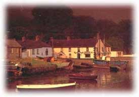
| The village in the 1970’s |
The prong, a barrel shaped boat, is unique to the area. It was renowned for its ability to be launched across the mud flats which are in abundance here. Its curved bottom allowed it to slide effortlessly across the mud and into the river, at even the lowest of tides. The timber punts of old are slowly being replaced with plastic, but some examples still remain. These are well worthy of retaining as are the skills of making, repairing and maintaining them.
As children we used the quay as one of our main playareas. This included football or hiding go seek on the green, swimming between the quays or hand lining for flounder or crabs. It also included a lot of jumping in and out of boats and of course gazing at the activities of the fishermen.
Fishermen employed a number of different methods in their trade in the village, and it depended on the time of year and what was in season. The principle fishery was the salmon. This season began on Feb 1st and continued till Aug 15th. Using drift-netting, (and perhaps some draft netting) at its height it would have employed up to 30 punts with a two man crew in each. On Saturdays the nets were hauled out and crews would stand around the quay “ranging them over” and mending holes caused by fast swimming fish or from snagging fouls in the river while drifting.
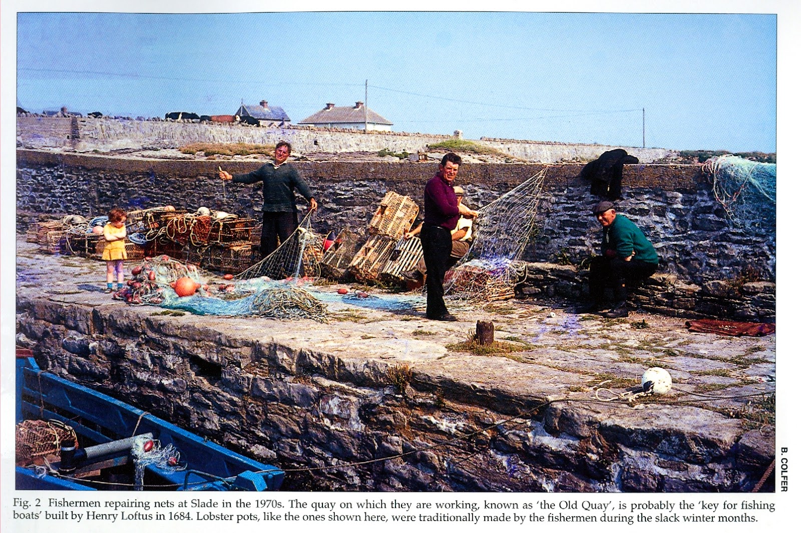
|
| net mending in Slade 1970sfrom Billy Cofers (RIP) book – The Hook |
Other methods of fishing which took place from the quays here included trawling, a two man activity using the larger yawls (previously sail boats but motorised from the 1940’s. The preferred method was a beam trawl, though the otter board method was also used. My lasting memory of trawling is with my father and uncle John. We had been “dragging” for a few hours and “hauled up” to see what we had caught. I don’t remember anything other than a very large conger eel that day. It trashed about in the net and when it finally got free it slithered about at a tremendous rate all around the deck of the boat. I remember standing on the gunwale while the two men battled to bring it under control and heave it over the side. The purple skin, dark eyes and slimy residue all left a bad image of this particular fish on me, one that still remains.
The autumn and winter fisheries were a bit of a mystery to me as we would have been more likely indoors or in school. The herring fishery began in November and could extend up to February. This required the Yawls, later motor boats, with a crew of initially four, but latterly three, and was a drift net fishery also. There was a Spillaring or long lining activity that perhaps has a long history in the area and this could be practiced from autumn to early spring. This employed the punts or prongs and targeted bottom fish such as cod. Shell fish gathering would have also been important, dragged up or picked directly from the rocks.
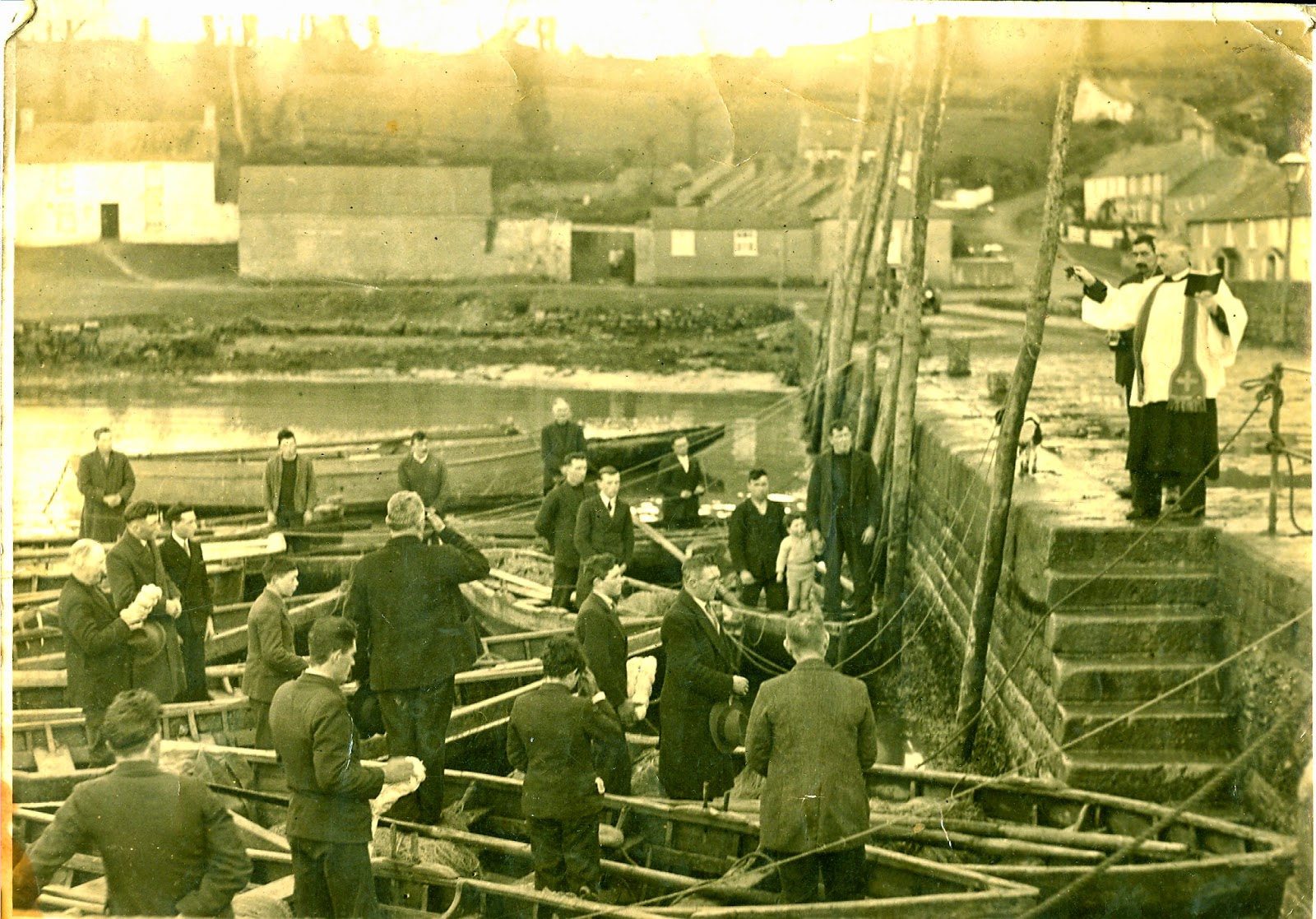
|
| Blessing of the boats 1930’s |
Although the fisheries have suffered many setbacks in the last ten years, perhaps the worst impact on the Quays was the construction of Groynes by Waterford Port Authority. The Groynes were constructed by dumping tens of thousands of tonnes of rock into the river at right angles to the river bank with the intention of keeping the Cheekpoint sandbank cleared. It worked better than the authorities said they expected, and the casualty was 24 hour access to the river for Cheekpoint.
Today, Cheekpoint quay still retains a hint of its past hustle and bustle, but what remains are only hints. Gone is the energy and excitement, gone is the huddled groups of sea booted fishermen swapping news, gone is the economic vitality it generated. Recreational use may bring some vitality in the future. However an equally essential ingredient, if only for the rich memories, will be some element of an economic fishery.
Looking on the OSI site at their historic maps of Ireland I learned that some of the first maps produced of the area, Historic 6" map doesn't show the lower quay, these were drawn between 1829-41. However, it is shown on the Historic 25" maps which were dated 1897-1913. Photos of the SS Pembroke aground at Cheekpoint for repairs in Feb 1899 do show the Lower quay, but at that stage the inner wall along the green is not in place. Pat Murphy told me recently that he remembers this being built as a child (late 1930's)
Bolton probably built the first quay. The Office of Public Works (Ireland) rebuilt the original quay and added the groyne in the 1880s to the designs of their Chief Engineer Robert Manning. Both were built in concrete, with the quay faced in stone. Cheekpoint is a very important early example of concrete use in a maritime environment.
Hi Elizabeth, yes Bolton was said to have initiated the first quay. An early map I have seen recently shows Cheekpoint as little more than a landing point to the east of this location, right at the tip of an area called the Sheag Rock where there appears to have been a motte and bailey type structure that was later reinterpreted in stone. Thanks for that.